
Essex Chain Lakes
Essex Chain Parking Reservation System (click here)
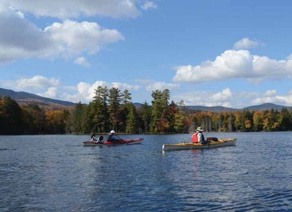
The Essex Chain Lakes Complex contains 18 water bodies totaling 785 acres that range in size from 3-acre Chub Pond to 216-acre Third Lake. Ten miles of the Hudson River on the eastern boundary and four miles of the Cedar River in the southern section make this is a paddler’s paradise.
Essex Chain Lakes
Paddlers can carry their canoe or kayak 0.25 mile to Deer Pond from the Deer Pond Parking Area at the end of the Cornell/Deer Pond Road. The 0.5-mile carry from Deer Pond to Third Lake is located directly across the pond on its southern shore.
Once in Third Lake, paddlers can access Second Lake by water and from there travel to First Lake using a 0.1-mile carry trail. On the northern shore of First Lake near its western end is the 0.4-mile carry to Grassy Pond.
In the other direction, paddlers can travel from Third Lake to Fourth Lake. Fifth Lake can be reached by paddling through the large culvert under the roadway or, during high water portaging, over the road. Paddlers can reach Sixth and Seventh Lakes directly from Fifth Lake.
Hudson River
Paddlers can travel nearly 12 miles on the Hudson River from Harris Lake in Newcomb to a landing just above the confluence with the Indian River. There are several stretches of flat but moving waters that people of all skill levels can enjoy, especially in the upper portion.
The river also contains numerous rapids and shallow rocky areas. Depending on water levels, the rapids are mostly rated Class 1, 2 or 2+. Under the certain water levels a few of the rapids may rate Class 3, such as Long Rapids and Ord Falls. Currently portages around these rapids have been flagged but carry trails have not been developed.
Among the waterbodies and the rivers of this property you can find both flat-water and whitewater paddling opportunities. During low water conditions (water levels below 4.0 at the North Creek gage) a considerable amount of portaging, dragging and lining of kayaks and canoes will be required especially in the lower portion of the river. Paddlers may put-in at the Town of Newcomb Boat Launch on Harris Lake and paddle across the lake and down the outlet to the Hudson River. Another access point is at the Polaris Bridge (aka Iron Bridge) which is reached via a 0.3-mile carry from the Hudson River/Polaris Bridge Parking Area located along Drakes Mill Road off the Chain Lakes Road North.
Less adventurous paddlers can take advantage of a long stretch of flat water above and below 28N or the Blackwell Stillwater section above and below the Polaris (Iron) Bridge landing site. Paddlers may also access the lower Goodnow River from the Blackwell Stillwater. The paddler put-in/take-out is located just south of the bridge on the west side of the river.
Trips shorter than the entire 12 miles can be taken by paddling from Harris Lake to the Polaris (Iron) Bridge Landing or from the Polaris (Iron) Bridge Landing to the Hudson River waterway access site just before the confluence with the Indian River.
The Outer Gooley Parking Area is located along the Chain Lakes Road South at the Old Gooley Farmhouse in the southern portion of the complex. The parking area is a 0.1-mile carry from the take-out point on the Hudson River just above the confluence with the Indian River.
Paddlers may park at the Old Red Finch Gate Parking Area along the Chain Lakes Road South. It is a 0.7-mile carry away from the take-out point on the Hudson River.
IMPORTANT NOTE: Paddlers who do not exit the Hudson River at the waterway access site before the confluence with the Indian River will paddle several miles of the Hudson River Gorge before reaching another point where they can exit the river.
Cedar River
Paddlers can access the Cedar River from the Outer Gooley Parking Area along the Chain Lakes Road South, at the Outer Gooley farmhouse. It is a 2.6-mile carry from the parking area to the Cedar River.
There is a flatwater section that stretches a short way upstream and downstream of the site where the road reaches the Cedar River.
Paddlers are asked to please give wide berth to anglers so as not to become entangled in the lines or disturb fish they are trying to catch.
Camping
General information on backcountry camping includes how-to and safety tips and links to rules and regulations.
There are 32 designated primitive tent sites and campsites currently available in the Essex Chain Lakes Complex. All are available on a first come – first served basis and cannot be reserved. Designated sites are marked with a yellow “Camp Here” disc. Designated tent sites are for tents only. Tents or small campers can use designated campsites. There are no hook-ups for water or electricity at campsites.
Waterfront Camping
There are 11 designated tent sites along the shores of the Essex Chain Lakes. View a map of tent sites (GeoPDF) (GeoPDF Instructions) Campers must abide by the following regulations:
• Camping around the Essex Chain Lakes and other nearby lakes & ponds waters is allowed at designated tent sites only;
• Campers must get a permit from the local Forest Ranger if they plan to spend more than three nights at a tent site; and
• No more than eight campers may stay at a tent site.
The campsite on Fifth Lake has accessible features for people with disabilities. While the site is available to people who do not have a need for accessible features, they are encouraged to use other waterfront campsites so this site can be available for those who do need accessible features.
Motorized Access Program for People with Disabilities (MAPPWD) permit holders obtain the combination to the lock on the gate at Deer Pond Parking Area by contacting the Warrensburg DEC office during regular business hours at (518) 623-1275. The two parking spaces at Fifth Lake are available on a first come -first served basis. Parking anywhere else along the road is prohibited.
Other Camping at the 21 other designated primitive tent sites within the Essex Chain Lakes Complex. Campfires are allowed at these tent sites and campers must comply with general state land use rules.
• Six tent sites are located off the Cornell/Deer Pond Road.
• One tent site is located near the Polaris (Iron) Bridge.
• Two tent sites are located on the north shore of First Lake and may only be used by float plane customers. Those wishing to experience camping by float plane should contact one of the Adirondack float plane operators.
• Four tent sites are located along the Camp Six Road which is open to public motor vehicle usage during the Northern Zone Regular Big Game Hunting Season. The tent sites are available year round but can only be accessed by hiking outside of the hunting season.
• Two designated roadside pull-off tent sites are located along the Chain Lakes Road South, between the Rafters Parking Area and Old Red Finch Gate Parking Area.
• Four tents sites are located along the Chain Lakes Road South north of the Outer Gooley Parking Area. Three of these tent sites are accessible by motor vehicle during the Northern Zone Regular Big Game Hunting Season, but can only be accessed by hikers during the rest of the year. The other one is north of a seasonal parking area and gate and can only be accessed by hikers year-round.
• Two tent sites are located on the shore of Pine Lake. One on the western shore is reserved for float plane customers only. The one on the eastern shore is accessed by hiking the Chain Lakes Road South to a trail to Pine Lake.
Campers who desire more amenities may camp at the nearby Newcomb Cafe & Campground, DEC Lake Harris Campground and Indian Lake Islands Campground and take day trips into the Essex Chain Lakes.
Horseback Riding
General information on horseback riding includes safety tips and rules and regulations. Proof of current negative Coggins certificate is required for all horses and out-of-state horse owners are required to produce a 30-day health certificate.
Nearly 22 miles of administrative roads in the Complex are open for horseback riding. The roads open for horseback riding are in the Horse Routes Map (PDF) and in the following list:
• 8.5 miles of the Chain Lakes Road North from the Goodnow Flow Road to the Cedar River;
• 1.5 miles of the Drake’s Mill Road from Chain Lakes Road North to the Hudson River Access Site at the Polaris (Iron) Bridge;
• 2.8 miles of the road from the Chain Lakes Road North to the road connecting with the Deer Pond Loop located north of Fifth and Sixth Lakes;
• 1.8 miles of road from the Chain Lakes Road North to the Deer Pond Loop;
• 2.5 miles of road looping around Deer Pond;
• 0.3 mile road from Chain Lakes North to Jackson Pond;
• 0.3 mile road from Chain Lakes North to Eighth Lake; and
• 3.0 miles of the Chain Lakes Road South from the Outer Gooley Parking Area to the Cedar River;
• 1.0 mile from the Chain Lakes Road South to Pine Lake.
More than thirteen miles of administrative roads are also open to use by horse drawn wagons. The roads open for use by horse drawn wagons are:
• 8.5 miles of the Chain Lakes Road North from the Goodnow Flow Road to the Cedar River;
• 1.5 miles of the Drake’s Mill Road from Chain Lakes Road North to the Hudson River Access Site at the Polaris (Iron) Bridge;
• 0.6 mile of the road from the Chain Lakes Road North to the campsite at Fifth Lake ; and
• 3.0 miles of the Chain Lakes Road South from the Outer Gooley Parking Area to the Cedar River.
The Essex Chain Lakes Road South can be accessed from the nearby community of Indian Lake and the Essex Chain Lakes North and the Deer Pond Parking Area can be accessed from the nearby community of Newcomb.
Horses and horses with wagons are prohibited beyond the Polaris (Iron) Bridge into the Vanderwhacker Mountain Wild Forest.
Horses and horses with wagons should not travel on the Goodnow Flow Road beyond the intersection with the Chain Lakes Road North. The Goodnow Flow Road becomes a private road shortly after the DEC sign for “Essex Chain Lakes and Hudson River Access” sign at the intersection with the Chain Lakes Road North. Turn left at the sign on to the Chain Lakes Road North.
Biking
General information on biking includes how-to and safety tips and links to rules and regulations.
Electric bicycles (E-bikes) of any class are not allowed on trails and roadways where public motorized access is prohibited.
Nearly 20 miles of administrative roads in the Complex are open for bicycling. The roads open for bicycle use are in the Bike Routes Map (PDF) and in the following list:
• 8.5 miles of the Chain Lakes Road North from the Goodnow Flow Road to the Cedar River;
• 1.5 miles of the Drake’s Mill Road from Chain Lakes Road North to the Hudson River Access Site at the Polaris (Iron) Bridge;
• 2.5 miles of road from the Chain Lakes Road North to the Deer Pond Parking Area;
• 2.5 miles of road looping around Deer Pond;
• 0.3 mile of road from Chain Lakes North to Jackson Pond;
• 3.0 miles of the Chain Lakes Road South from the Outer Gooley Parking Area to the Cedar River; and
• 1.0 mile of road from the Chain Lakes Road South to Pine Lake.
The Essex Chain Lakes Road South can be accessed from the nearby community of Indian Lake and the Essex Chain Lakes North and the Deer Pond Parking Area can be accessed from the nearby community of Newcomb.
Biking is prohibited beyond the Polaris (Iron) Bridge into the Vanderwhacker Mountain Wild Forest.
Bicyclist should not travel on the Goodnow Flow Road beyond the intersection with the Chain Lakes Road North. The Goodnow Flow Road becomes a private road shortly after the DEC sign for “Essex Chain Lakes and Hudson River Access” sign at the intersection with the Chain Lakes Road North. Turn left at the sign on to the Chain Lakes Road North.
Hunting and Trapping
General Information on hunting and general information on trapping includes how-to and safety tips with links to seasons, rules and regulations.
All the lands and waters within the Essex Chain Lakes are open to hunting and trapping. Hunters and trappers may use the parking areas, roads, seasonal access roads, trailheads, and trails used by hikers, boat launches and hand launches used by boaters and paddlers to access the lands and waters in this area. Hunters can park on the shoulders of seasonal access roads provided vehicles are out of the travel lane.
Two seasonal access roads are opened for the Northern Zone Big Game Hunting Season. The roads are closed to motor vehicle access outside of the hunting season.
Camp Six Road (PDF) extends one mile from a gate on the Chain Lakes Road North to the four vehicle parking area. The parking area provides access to thousands of acres of lands between the Essex Chain Lakes and the Hudson River including Cedar Mountain.
Motor vehicle access is extended another 1.5 miles past the gate at the Outer Gooley Parking Area on the Chain Lakes Road South (PDF) during the big game hunting season. Motor vehicle access ends at a gate at a four-vehicle parking area. The parking area provides access to thousands of acres of forest preserve lands south of the Cedar River and west of the Hudson River which include Pine Lake.
These seasonal access roads are dirt and gravel roads and may be rough and muddy with rocks sticking up in locations. Pickup trucks, SUVs and other high axle vehicles are recommended – four wheel drive vehicles will serve even better.
Big game hunters may obtain a permit from the local Forest Ranger to camp on Forest Preserve lands in this unit for the length of the Northern Big Game Season, except at tent sites in the camping permit system.
Fishing
General information on fishing includes fishing tips with links to seasons, rules and regulations. You can ensure of continued good fishing opportunities in the future by fishing responsibly. If you have never been fishing but want to try, it’s easy to learn how to fish.
All waters within the Essex Chain Lakes are open to fishing. Anglers may use the same trailheads and trails as hikers, the same hand launches as paddlers, the same boat launches as boaters, and the same camp sites as campers to access and fish these waters.
Anglers can fish for landlocked salmon and rainbow trout in Third Lake and Fifth Lake; and brook trout in Pine Lake, Eighth Lake, Deer Pond, and Jackson Pond; or native lake trout and rainbow trout in Clear Pond.
The flatwater sections of the Hudson River provide good fishing opportunities for smallmouth bass, northern pike and panfish. In the stretch just south of Route 28N anglers may find walleye and an occasional largemouth bass.
The Hudson River between the Cedar River and the Indian River contains brown and rainbow trout.
Anglers can fish the Cedar River for brook and brown trout. The river can be accessed along the Elm Island Trail or from the Outer Gooley Parking Area.
Bullhead Pond contains brook trout and can be reached from the Rafters Parking Lot on the Chain Lakes Road South via a 0.6 mile trail, through easement lands. Anglers should stay on the trail and avoid trespassing on private lands.
Several other rivers and streams flow into and out of the Complex including the Goodnow River, Rock River, Indian River, and a number of small streams.
Adirondack/Lake Champlain Fishing provides information on fishing in the Adirondacks and links to top fishing waters, stocking lists, public fishing access and waters open to ice fishing listed by county.
Protect Native Adirondack Fish; populations of brook trout, round whitefish and other native Adirondack fish species have severely declined due to introduced fish.
Hiking
General information on hiking includes how-to and safety tips and links to rules and regulations.
The Essex Chain Lakes Complex has a network of old logging roads that are open to hiking. These roads are neither maintained nor marked at this time.
The Upper Hudson Loop Trailhead and parking area, located off the Goodnow Road, provide access to the Upper Hudson Loop Trail (PDF). The trail is 4.2 miles and parallels the Goodnow River (south side) to the Hudson River. The trail heads north along the Hudson for a short distance before looping back and reconnecting with itself 0.5 mile from the trailhead. Vehicles should not be parked on nearby lands posted by the Goodnow Flow Association.
Elm Island Trail is accessed from an informal parking pull-off at the end of Pelon Road. The trail is 3.7 miles (one-way) to Elm Island. A separate loop from the Elm Island Trail to the Pasley Ski Trail and back to the trailhead is 3.0 miles.
Fire Tower
General information on fire towers includes historic and current uses of fire towers and links to other locations with fire towers.
The 60-foot tall Goodnow Mountain Fire Tower is listed in the National Historic Lookout Register. The cab of the fire tower is open to the public and provides a 360 degree view of the Central Adirondacks.
The current steel AerMotor Model #LS‐40 fire tower was constructed in 1922 to replace a wooden fire tower on nearby Dunn Brook Mountain. The fire tower was staffed and used for fire observation until 1979. The fire tower and Goodnow Mountain are part of the 15,000-acre Huntington Wild Forest managed by the SUNY College of Environmental Science and Forestry’s Adirondack Ecological Center (AEC) (leaves DEC website).
The trail to the summit and the fire tower are maintained by AEC. The trail is an interpretive trail and a brochure may be obtained at the trailhead. Interpretive information in the fire tower’s cabin informs visitors about the tower’s history and provides guidelines for identifying the surrounding landforms.
Cross-country Skiing and Snowshoeing
General information on cross-country skiing and snowshoeing includes how-to and safety tips and links to rules and regulations.
The network of many miles of former logging roads in the Essex Chain Lakes Complex is open to the public for cross-country skiing and snowshoeing. These roads are neither maintained nor marked at this time.
The Upper Hudson Loop Trail and the Elm Island Trail, as described in the Hiking section, are also recommended for cross-country skiing and snowshoeing.
Accessible Recreation
A designated accessible two-vehicle parking area, an accessible campsite and an accessible hand launch are located at Fifth Lake (PDF). The parking lot may be accessed by Motorized Access Program for People with Disabilities (MAPPWD) permit holders. MAPPD permit holders may obtain the combination to the lock on the gate at Deer Pond Parking Area by contacting the Warrensburg DEC office during regular business hours at (518) 623-1275. The two parking spaces are available on a first-come, first-served basis.
Parking anywhere along the access road between the Deer Pond gate and Fifth Lake is prohibited.
A hardened path from the parking area provides access to a nearby accessible primitive tent site on the southwest shore of Fifth Lake. Take a left at the fork in the path to reach the tent site which has a hardened surface and tent pad, and an accessible privy. This site may be used by the general public, but those not requiring accessible features are encouraged to use other sites.
Take a right at the fork in the hardened path from the parking also leads to reach an accessible hand launch. People with a valid MAPPWD permit must contact the Warrensburg DEC office during regular business hours at (518) 623-1275 and provide them with their permit number to obtain the combination to the lock on the gate at Deer Pond Parking lot.
Wildlife
General information on animals includes links to information about birds, mammals, fish, reptiles, amphibians and insects that inhabit or migrate through the state.
The Adirondacks contain large tracts of wildlife habitat with some boreal, bog, alpine and other unique habitats. Many species of birds and mammals are unique to the Adirondacks or are mainly found here. More than 50 species of mammals and hundreds of species of birds inhabit or pass through the Adirondacks at one time of the year or another so it is not unlikely to catch site of wildlife during your trip.
More information on Adirondack Flora and Fauna from the SUNY ESF Adirondack Ecological Center.
You can protect wildlife and wildlife habitat when viewing them.
Wildlife Found in the Adirondacks
Mammals
◦ Moose
◦ Beaver
Birds
◦ Osprey
Directions
The main point of entrance to the northern portion of the Essex Chain Lakes Complex is by the Goodnow Flow Road which is reached by turning south onto Pine Tree Road, a short loop off State Route 28N in Newcomb. The main point of entrance to the southern portion of the Essex Chain Lakes Complex is the Chain Lakes Road South off Route 28 in Indian Lake.
All coordinates provided are in decimal degrees using NAD83/WGS84 datum.
Parking Areas
• Deer Pond Parking Area along the Cornell/Deer Pond Road is the main point of access for the Essex Chain Lakes and surrounding water bodies (43.8866°N, 74.2640°W) Google Map (leaves Town of Newcomb website)
• Hudson River/Polaris (Iron) Bridge Parking Area along the Chain Lakes Road North is the main motor vehicle access for the Blackwell Stillwater section of the Hudson River. (43.8952°N, 74.1690°W) Google Map (leaves Town of Newcomb website)
• Pelon Road River Parking Area is located at the end of Pelon Road off State Route 30 (43.7980°N, 74.2750°W) Google Map (leaves Town of Newcomb website)
• Old Red Finch Gate Parking Area is located on the Chain Lakes Road South about three miles from Route 28 and provides access to the Hudson River take out site (43.8168°N, 74.2068°W) Google Map (leaves Town of Newcomb website)
• Old Outer Gooley Club Parking Area provides access to the Hudson River take out site, the waters of the Pine Lakes Primitive Area and the Cedar River (43.8275°N, 74.2008°W) Google Map (leaves Town of Newcomb website)
• The seasonal hunter access parking area on the Chain Lakes Road South is 1.5 miles north of the Outer Gooley Parking Area. The parking area is only open during the Big Game Hunting Season (43.8407°N, 74.2206°W) Google Map (leaves Town of Newcomb website)
• Upper Hudson Loop Trailhead and parking area is located on the left side of the Goodnow Road just before it crosses the bridge over the Goodnow River. (43.9150°W, 74.1855°N) Google Map (leaves Town of Newcomb website)
• The seasonal hunter access parking area is located at the end of the Camp Six Road Parking Area extends one mile from a gate on the Chain Lake North Road. This parking area is only open during the Big Game Hunting Season (43.8782°N, 74.1949°W) Google Map (leaves Town of Newcomb website)
Boat Launch
• Town of Newcomb Boat Launch is located on Harris Lake/Beach Road and is the main point of entry to Harris Lake and the section of the Hudson River between the lake and the Iron Bridge. (43.9717°N, 74.1459°W) Google Map (leaves Town of Newcomb website).
Rules, Regulations and Outdoor Safety
Practice Leave No Trace (leaves Town of Newcomb website) principles when recreating in the Adirondacks to enjoy the outdoors responsibly; minimize impact on the natural resources and avoid conflicts other backcountry users.
All users of Essex Chain Lakes Complex must follow all State Land Use Regulations and should follow all Outdoor Safety Practices for the safety of the user and protection of the resource.
Biking is prohibited beyond the Polaris (Iron) Bridge into the Vanderwhacker Mountain Wild Forest.
Motorized boats are not permitted by the public in any of the area waters.
Goodnow Flow Road is a private road beyond the intersection with the Chain Lakes Road North and should not be used by the public.
Planning and Management
DEC manages these lands in accordance with the 2016 Essex Chain Lakes Management Complex Plan (PDF, 10 MB). In addition to management objectives, the Complex Plan contains detailed information on natural features, recreational infrastructure, geology, natural and human history, habitats, wildlife, fisheries and much more. The UMP was amended in 2021 (PDF) to allow for campfires at shoreline tent sites and to develop additional equestrian facilities.
In December 2018, DEC issued a Wild, Scenic and Recreational Rivers Permit (PDF) for work related to the construction of a bridge over the Cedar River.
Nearby State Lands, Facilities, Amenities and Other Information
State Lands and Facilities
• Camp Santanoni Historic Area
• Vanderwhacker Mountain Wild Forest
• Adirondack Interpretive Center (leaves Town of Newcomb website)
• Indian Lake Islands Campground
Gas, food, supplies, dining and lodging may be found in the nearby communities of Minerva, Newcomb, and Indian Lake.
Adirondack Regional Tourism Council (leaves Town of Newcomb website) and the Hamilton County Tourism Office (leaves Town of Newcomb website) provide information on recreational opportunities, attractions, lodging, dining and other amenities in the area.
Numerous guide books and maps are available with information on the lands, waters, trails and other recreational facilities in this area. These can be purchased at most outdoor equipment retailers, bookstores, and on-line booksellers.
Additional information, outdoor equipment, trip suggestions and guided or self-guided tours may be obtained from outdoor guide and outfitting businesses. Check area chambers of commerce, telephone directories or search the internet for listings.
Consider hiring an outdoor guide if you have little experience or woodland skills. See the NYS Outdoor Guides Association (leaves Town of Newcomb website) for information on outdoor guides.